Real time smart track location screen
This topic describes the purpose of the Real time smart track location screen and all the settings and buttons on it.
This feature requires option E10 Live location monitoring. If you do not have this option this screen is not available.
The Real time smart track location screen allows you to view the data and location associated with live location monitoring events and create a geo-fence or reverse geo-fence alert based on an existing ping location. If you want to analyze the data further you can open the ESPA analysis center screen.
The screen can be opened from either an email or SMS sent to you regarding a live location monitoring alert configured on the Smart Track alerts & notifications screen and from the triggered alerts displayed on the Smart Track triggered alerts screen.
The following graphics show some examples:
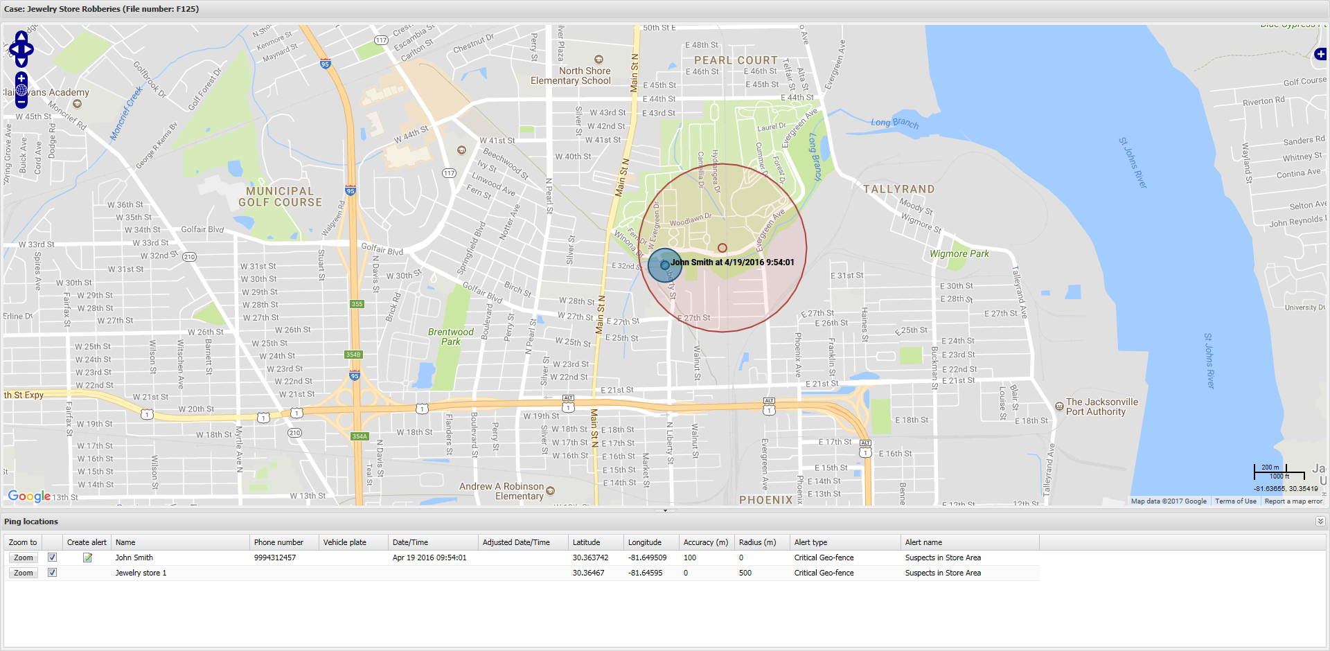
The first record provides details on the phone user, their location and the location accuracy. The second record provides details of the location area the phone user has entered. So in this example the phone user is within the 500 m radius set for the location. It is a critical alert because the accuracy of the phone users location indicates that they are definitely in the location area.
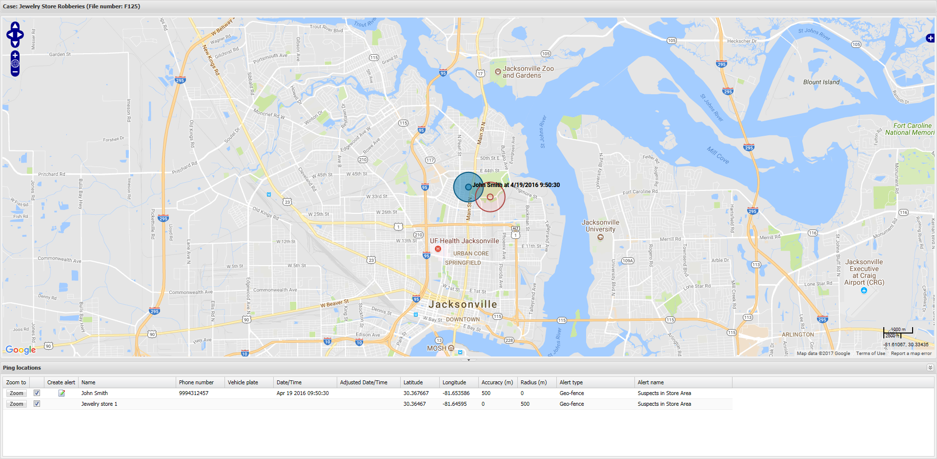
The first record provides details on the phone user, their location and the location accuracy. The second record provides details of the location area the phone user has entered. So in this example the phone user is potentially within the 500 m radius set for the location. It is not classed as a critical alert because the accuracy of the phone users location indicates that they may be in the location area, unlike the previous example where the accuracy of the data does indicate that they are definitely in the location area.
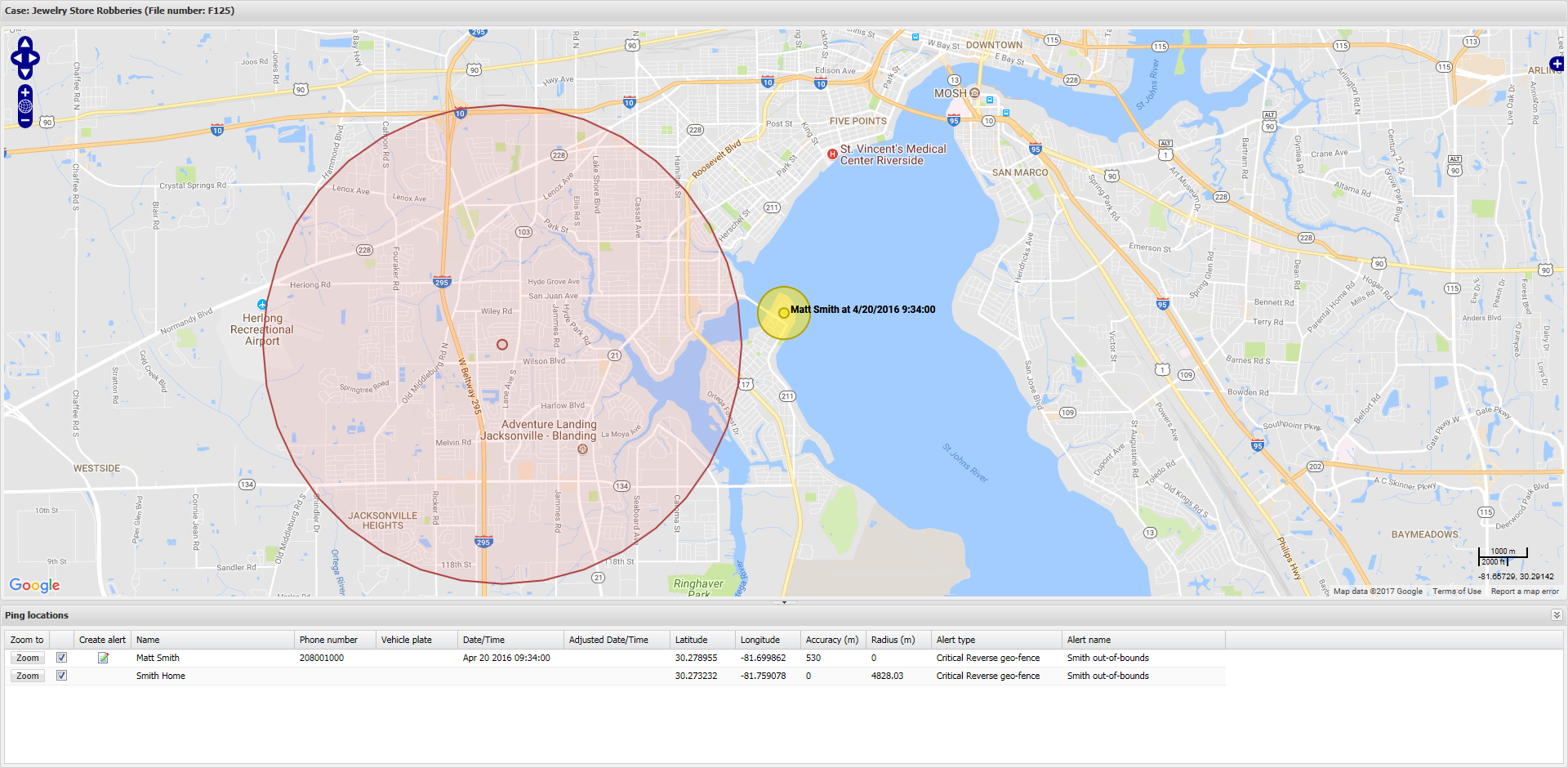
The first record provides details on the phone user, their location and the location accuracy. The second record provides details of the location area the phone user has exited. So in this example the phone user is outside the 3 mile (4828.03 m) radius set for the location. It is a critical alert because the accuracy of the phone users location indicates that they are definitely outside the location area.
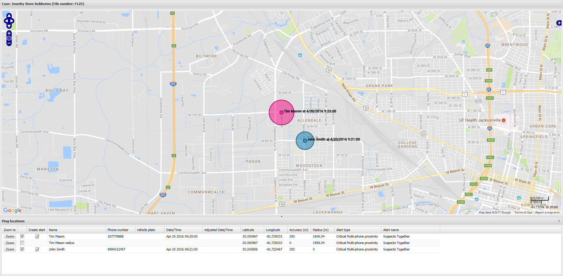
The first and third records provide details on the phone users involved, their location and their location accuracy. The second record provides details of the area surrounding the first phone user, which includes the location buffer and the accuracy of the previous phone users location. So in this example the second phone user is within the 1 mile (1609.34 m) radius set for the location including the 350 m accuracy of their location, that is a total of 1959.34 m. It is a critical alert because the accuracy of the phone users locations indicate that they are definitely within 1 mile from each other.
Click to center the selected item on the map.
Select the check box to display the selected item on the map.
Click to create a new geo-fence or reverse geo-fence alert based on the location of the selected ping. The Create an alert from selected location dialog box opens. For further information refer to How to create a real time smart track alert based on a ping location.
If the record is for a:
- GPS ping this displays the person's name.
- location this displays the location's name.
- radius surrounding a phone user in a multi-phone proximity alert then this displays the person's name and the word "radius".
If the record is for a GPS ping from a phone then the phone number is displayed here. For other record types this field is empty.
If the record is for a GPS ping from a vehicle then the vehicle plate is displayed here. For other record types this field is empty.
If the record is for a GPS ping the time of it is displayed here. The time displayed is that from the GPS ping email; that is, the time of the GPS ping in the location the GPS ping occurred.
For other record types this field is empty.
If the record is for a GPS ping the time of it is displayed here. The time displayed is your local time
For other record types this field is empty.
If the record is for a:
- GPS ping then these display the latitude and longitude values supplied by the live location monitoring email from the network operator.
- location then these display the latitude and longitude values.
- radius surrounding a phone user in a multi-phone proximity alert then these display the latitude and longitude values supplied by the live location monitoring email from the network operator.
If the record is for a GPS ping then this displays the accuracy of the call position which is supplied by the live location monitoring email from the network operator.
For other record types this field is empty.
If the record is for a:
-
location then this displays the radius from the location that defines when an alert is triggered. If the location has a Location buffer set on the Locations of interest screen (Case management). However, if it does not then the value displayed is the Location buffer set using the Smart Track alerts & notifications screen.
- radius surrounding a phone in a multi-phone proximity alert then this displays the Location buffer set using the Smart Track alerts & notifications screen combined with the accuracy of the named phone users location as supplied by the live location monitoring email from the network operator.
If the record is for a GPS ping this field is empty.
For all records this displays the type of alert that was triggered.
For all records this displays the name of the alert as set using Alert name on the Smart Track alerts & notifications screen.